Photo: N. Lewin
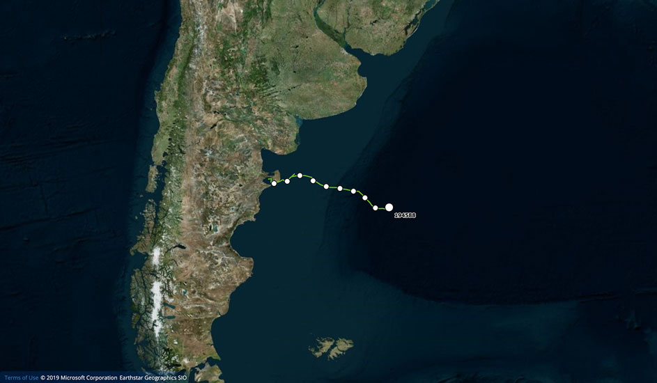
Pulgarcita’s 35 day tracking route (2,467 km)
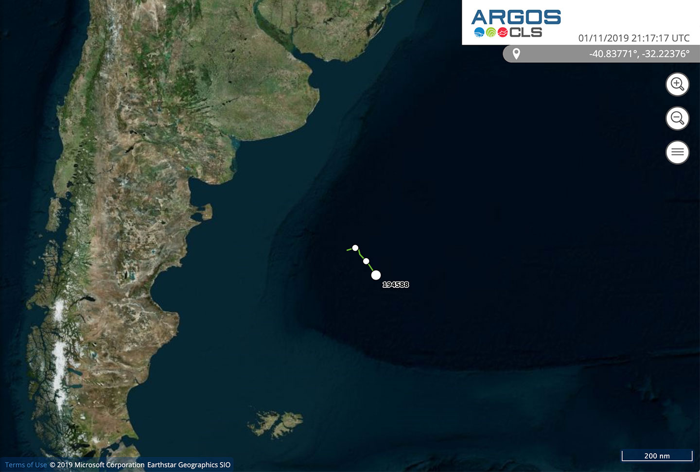
October 27 – October 30, 2019
Pulgarcita left Golfo Nuevo, and swimming at a constant speed, crossed the continental shelf and then the continental slope. In the last few days she changed direction and began swimming towards the southeast, possibly heading like other right whales to feed in the zone of the South Georgia Islands. In the past as well as at present the ocean surrounding these islands has been important to this species. The largest island at one time had seven whaling stations on its northern coast, all of which operated continuously during the first half of the 20th century.
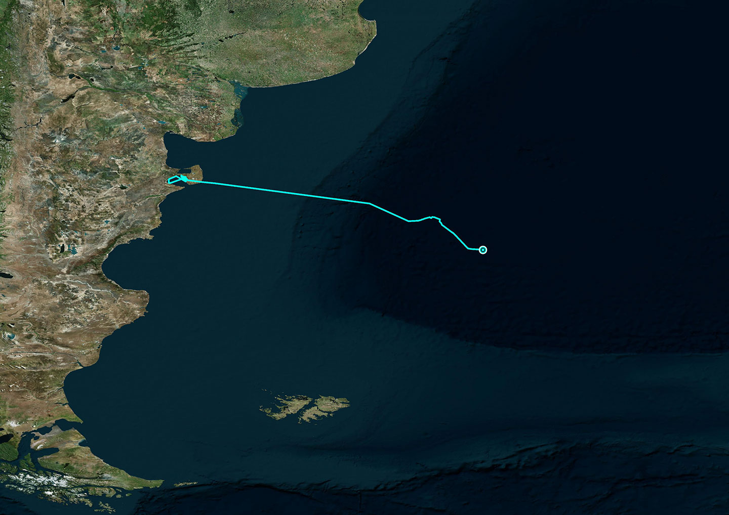
October 16 – October 26, 2019
This mother and her calf left Golfo Nuevo on October 16 heading towards the South Atlantic Ocean Basin. They are now more than 800 kilometers east of the Valdes Peninsula and in waters more than 5 kilometers deep.
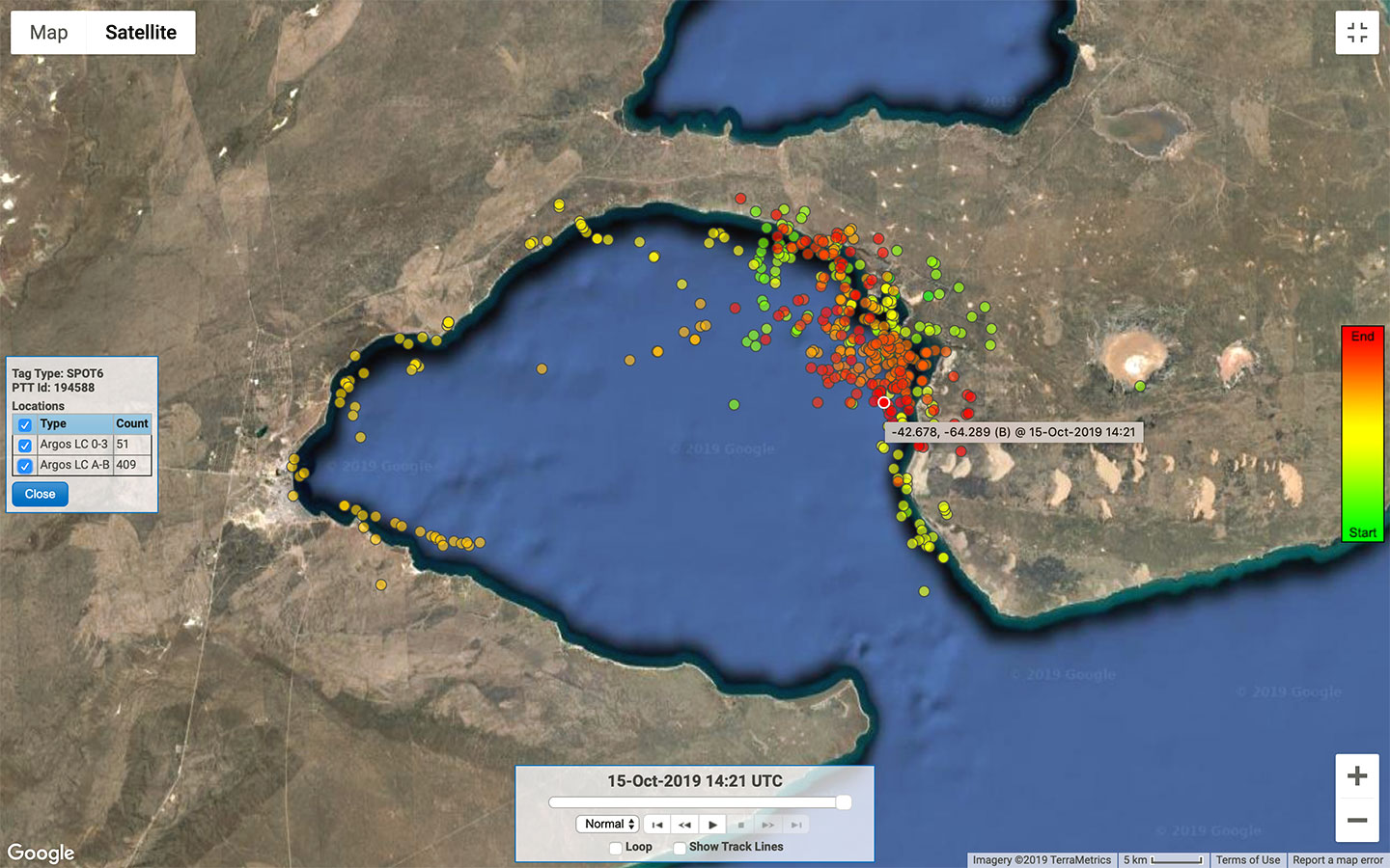
September 25 – October 15, 2019
Pulgarcita is an adult female who has had a satellite transmitter since September 25. She and her calf have spent most of their time in the area of Puerto Pirámides, the town from where the whale watching tourist boats leave. It should be mentioned here that these businesses which provide tourist services also contribute to this project by informing the scientists of the presence of whales with satellite transmitters attached.