Photo: R. Soley
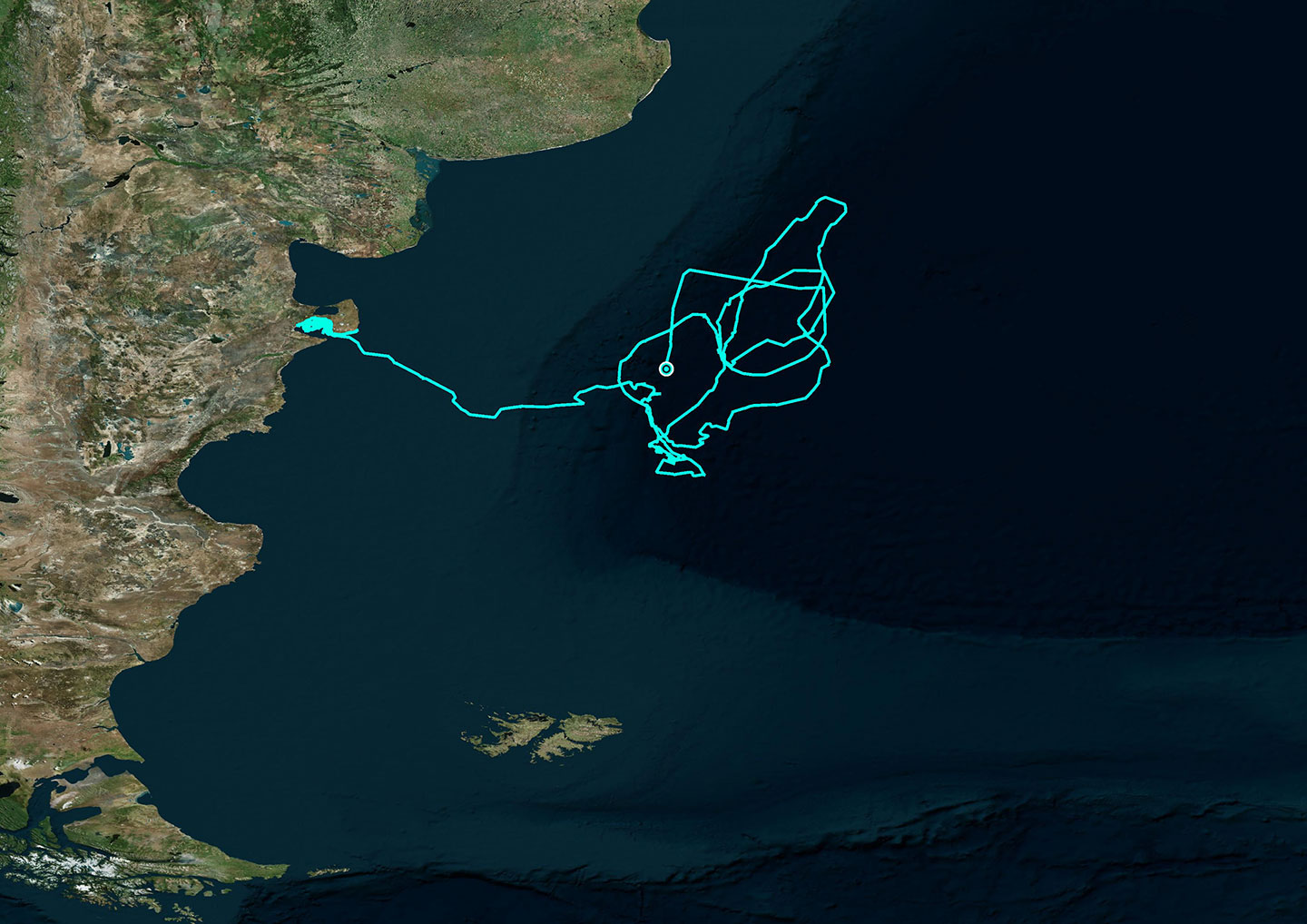
Diana’s 121 day tracking route (10,310 km)
January 21 – January 23, 2020
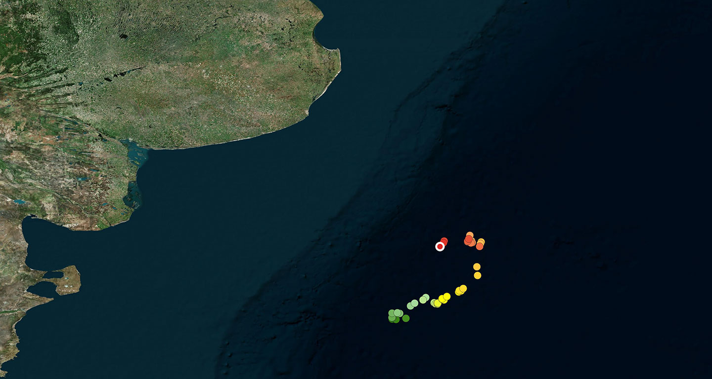
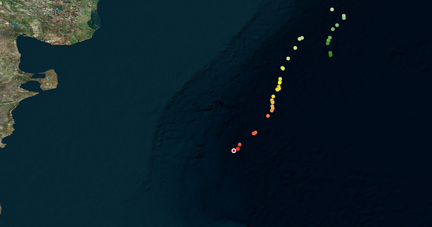
On January 23, while Diana and her calf were traveling south, Diana’s transmitter ceased sending data. This was 121 days after deployment. Diana traveled more than 5000 kilometers since leaving Golfo Nuevo on November 16. While we tracked her in the deep ocean she frequently used circular water currents to find food.
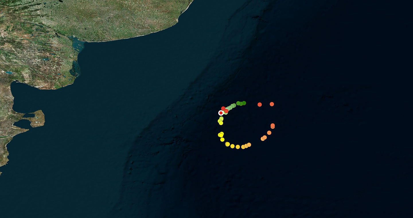
January 12 – January 20, 2020
Diana and her calf swam in an almost perfect circle, tracing large counterclockwise currents present in this zone. Within the contours of these marine whirlpools a mixing of adjacent waters occurs which concentrates nutrients on the surface and favors the growth of the small crustaceans which are the food of right whales.
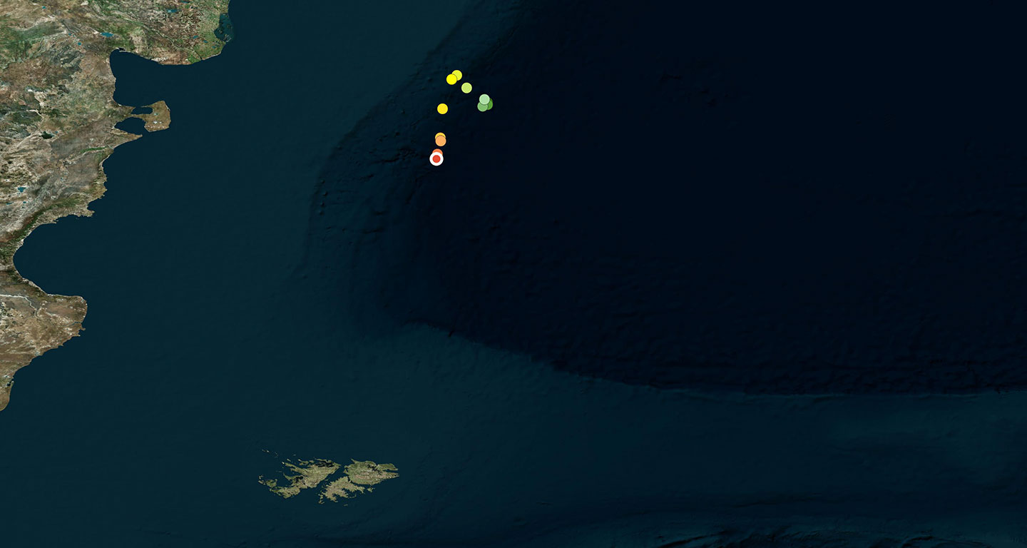
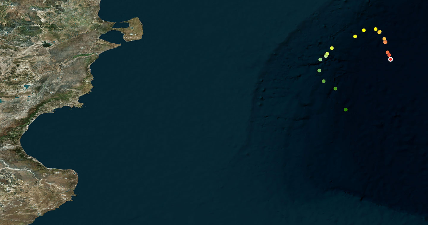
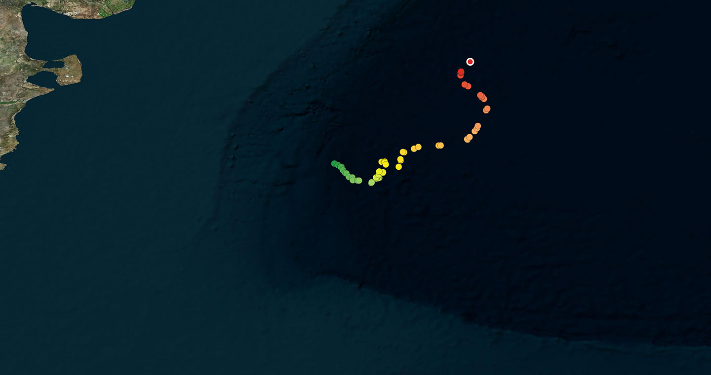
January 06 – January 11, 2020
Diana and her calf have been transmitting data for 108 days. This week they traveled northeast, then stopped in an area where Legal also is, in the deep Ocean Basin.
December 29, 2019 – January 05, 2020
Diana and her calf traveled to the northwest until they reached the continental slope. From there they headed northeast, and upon reaching the latitude of the northern part of the Valdés Peninsula, they turned south. At present they are only 14 kilometers from Cebollita and her calf.
December 22 – December 28, 2019
During this past week Diana and her calf swam first in a small counterclockwise circle and then swam off to the northeast. We’ll see if they find food in these deep waters in the coming days, or if they continue moving around.
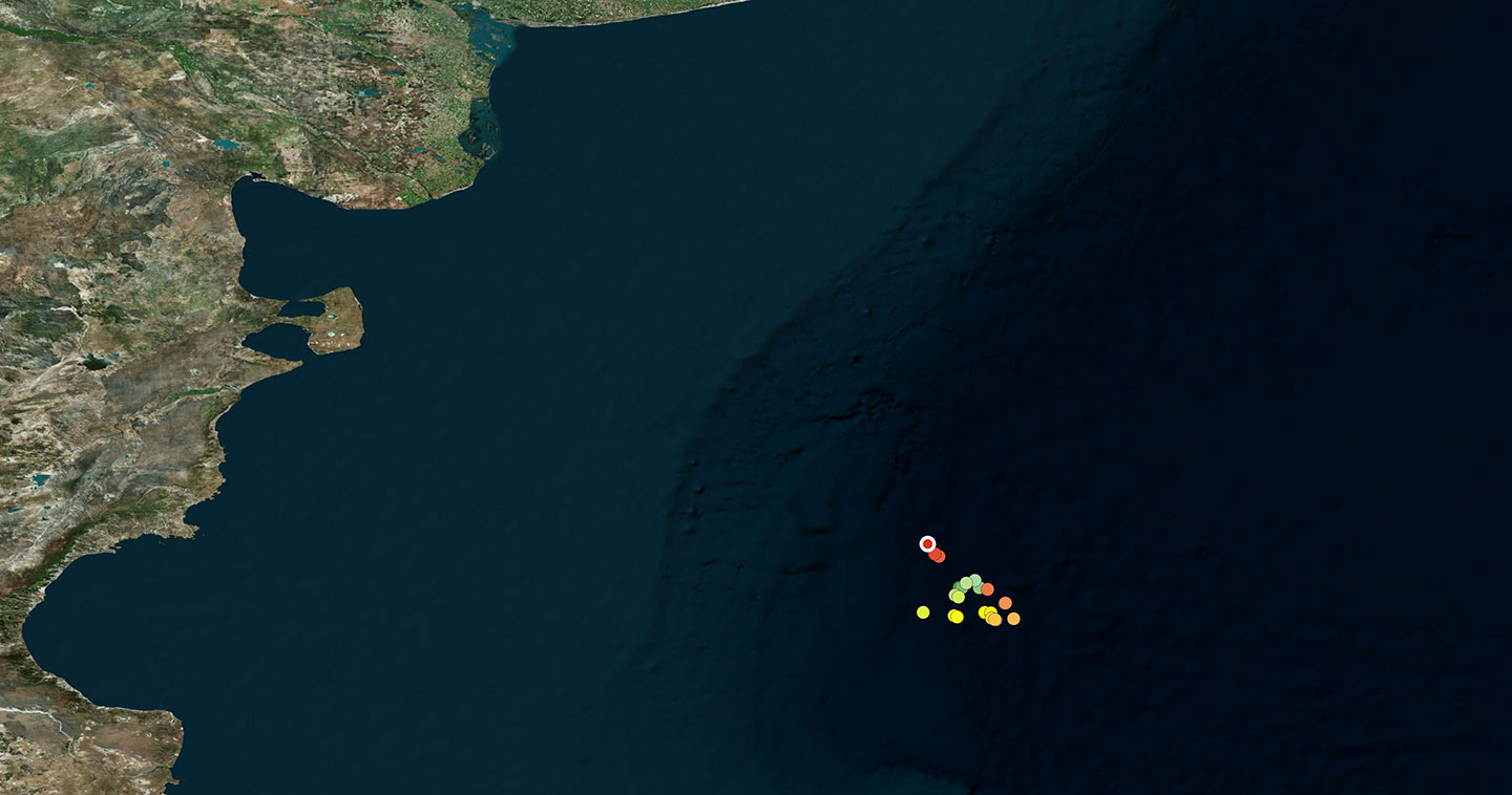
December 16 – December 21, 2019
Diana and her calf found an area in the center of the oceanic basin with abundant food, as Afuerita and her calf had done before her. During this past week they swam within an area of less than 3,000 square kilometers.
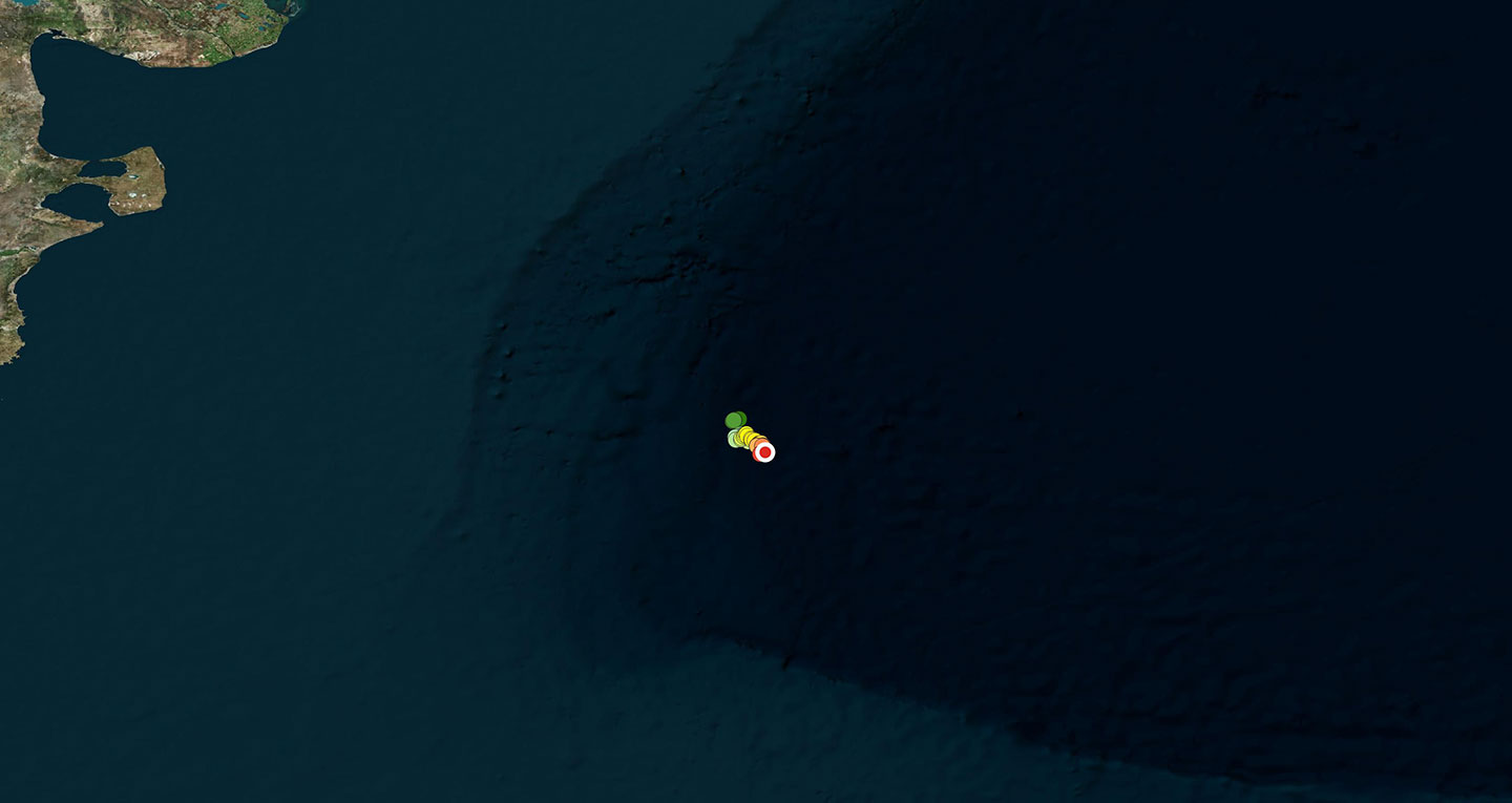
December 05 – December 15, 2019
Diana, who seems to not able to make up her mind, is now swimming southward against the current. For a few days she swam towards the northeast, but then changed direction and swam towards the area where the other mothers are presently feeding, in the very deep waters next to the Blue Hole.
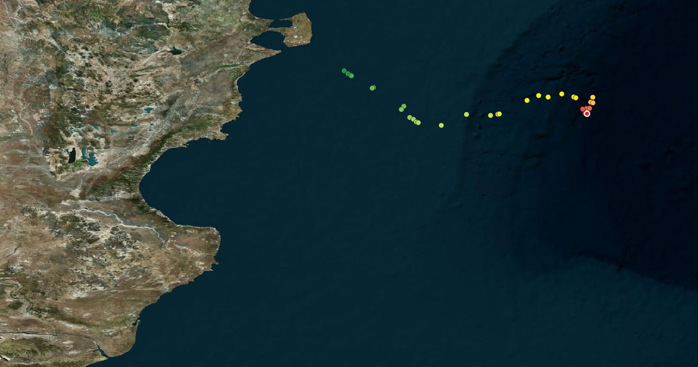
November 26 – December 04, 2019
During these last days Diana and her calf began swimming towards the northeast, traveling a route similar to that traveled last week by Afuerita. They may be using circular ocean currents to find zones with “whale food”.
November 17 – November 25, 2019
This mother and her calf began swimming east and after four days traveling in that direction it seems that Diana found an area where she could feed. Whale mothers try to recuperate their lost body weight rapidly after their prolonged fast during their stay in the Valdés gulfs.
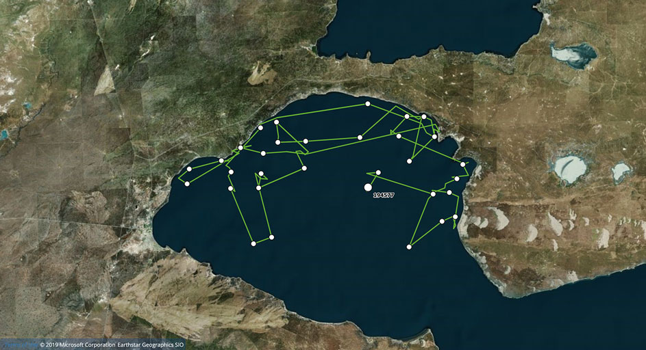
November 10 – November 16, 2019
After remaining for a week close to the northern coast of the entrance to the gulf, between Punta Cormoranes and Moro Nuevo, Diana and her calf are now swimming in the open ocean. They may have begun their migration to the feeding areas.
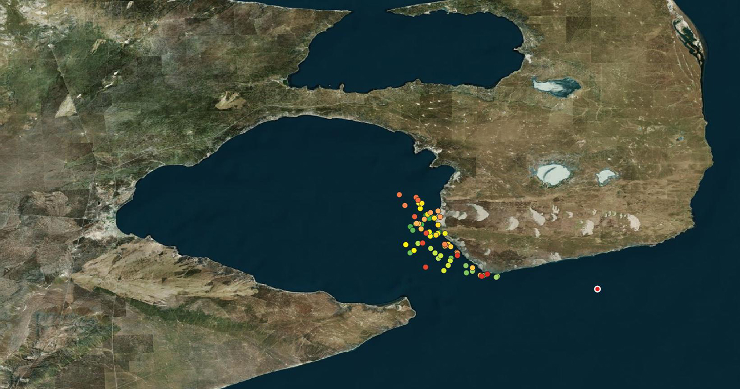
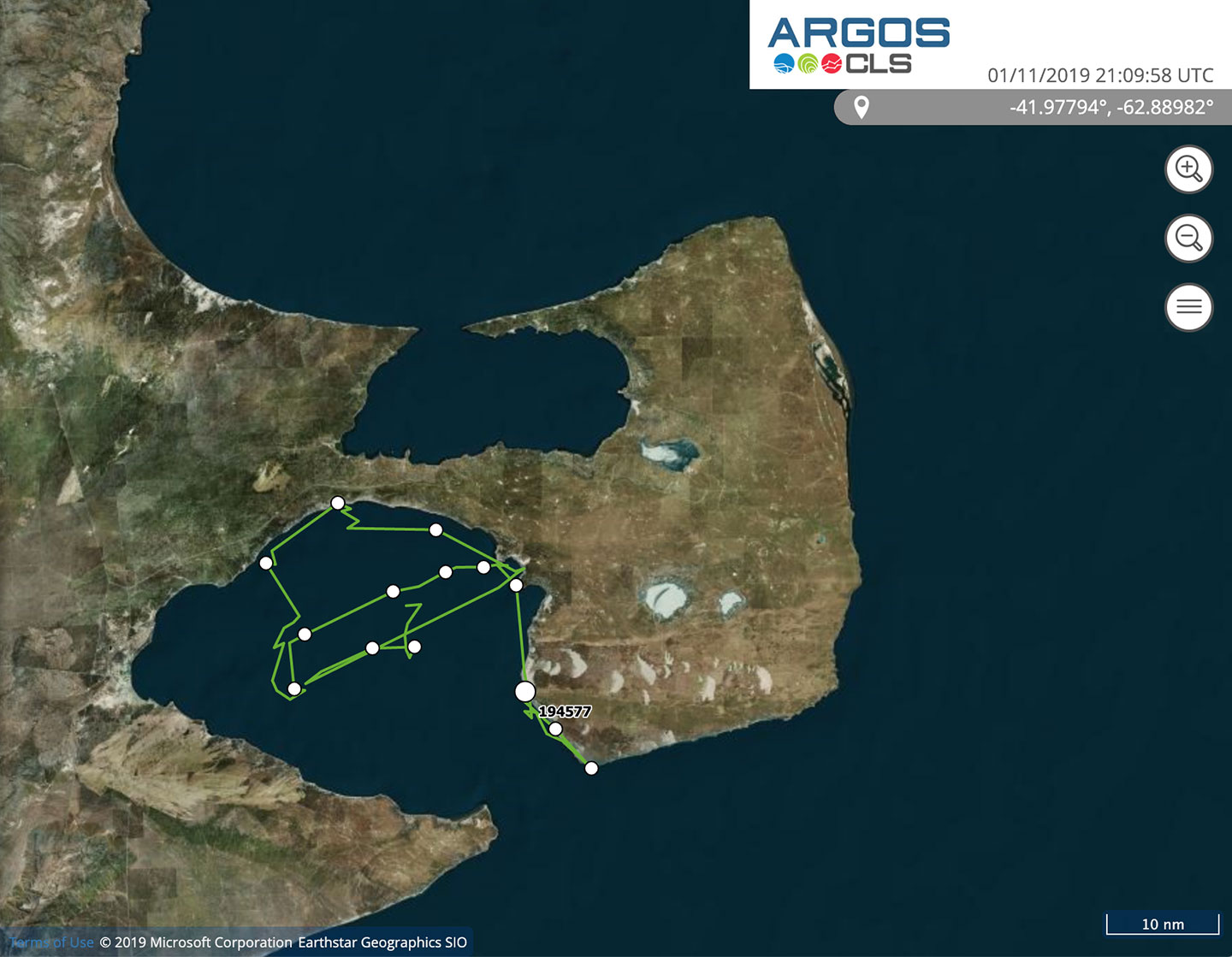
November 2 – November 9, 2019
Diana and her calf left Golfo Nuevo, and swam along the southern coast of the Valdes Peninsula up to Punta Delgada. This mother then decided to return to the protected waters of the gulf.
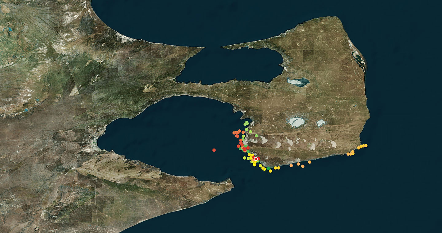
27 de Octubre – 01 de Noviembre 2019
Diana seemed to be leaving Golfo Nuevo, but then changed her mind and returned to the area of Puerto Pirámides. She was observed by the tracking team a few days ago. She is a female and is about 16 meters long. Her calf, about average size for whale calves, was about 5 meters long at birth. During these weeks of lactation this calf will grow rapidly, growing larger and stronger, so as to be better prepared to start its migration.
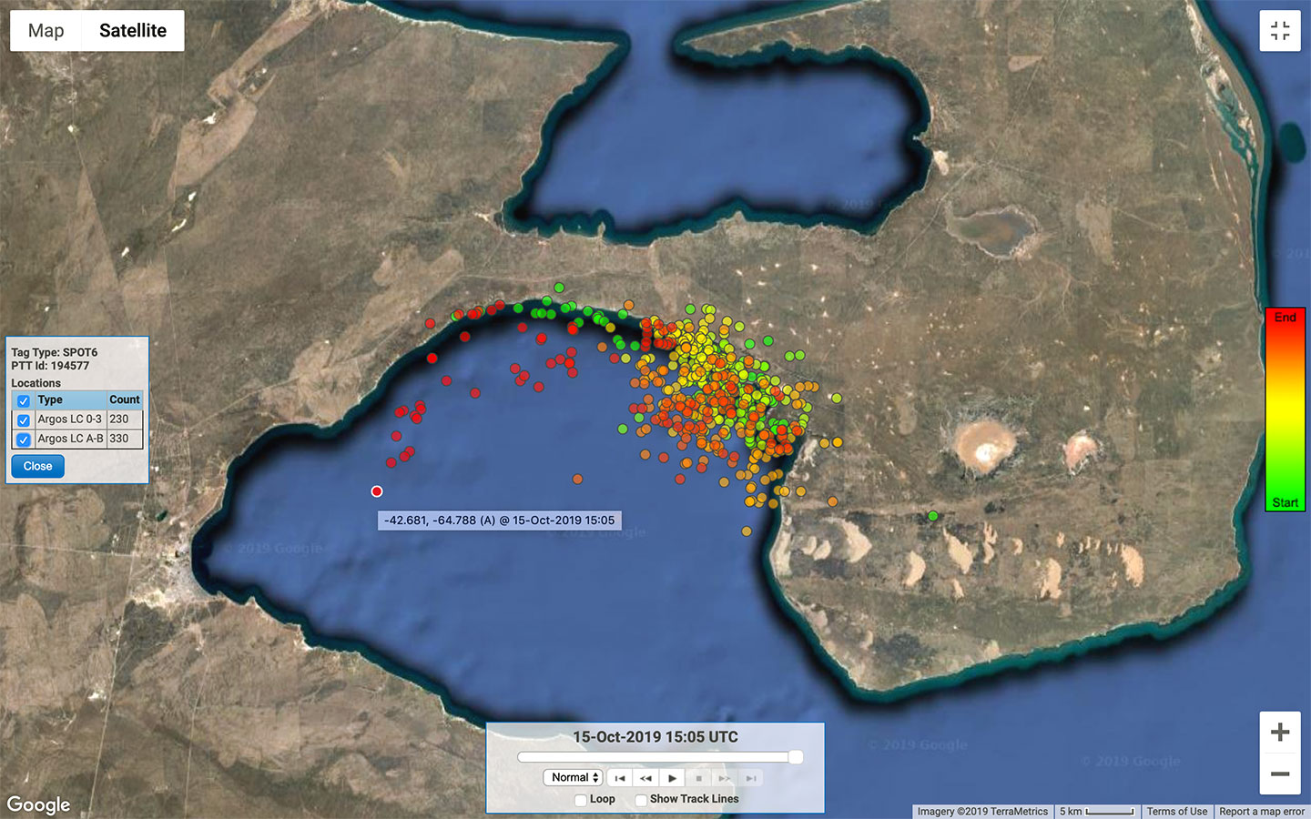
October 16 – October 26, 2019
Diana continues swimming around in Golfo Nuevo. On October 18 the tracking team which monitors these whales from boats observed her and her calf swimming tranquilly. There was no evidence of any reaction whatsoever to the satellite transmitter she has attached, which will detach in a short time.
September 24 – October 15, 2019
Diana, accompanied by her calf, remained in the immediate vicinity of Puerto Pirámides for a long time. She is now in the deeper waters of the gulf, in the anchorage zone of Puerto Madryn. It should be noted that in these last few months, on days when there were strong winds, more than 80 commercial fishing boats took refuge from the storms in this area of the gulf. It is of utmost importance that the captains of boats which navigate inside Golfo Nuevo be aware of the presence of whales at this time of year.