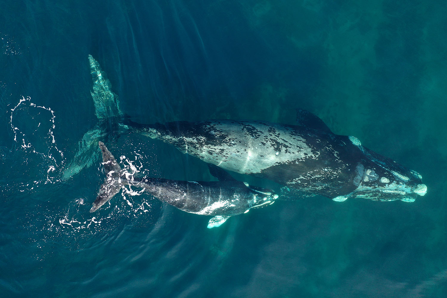
The routes traveled by 22 Southern Right Whales are currently being recorded in this seventh season of the “TrackingWhales” project. As in previous years, the whales’ movements are updated daily on the www.siguiendoballenas.org website. This year state-of-the-art satellite transmitters were deployed on 16 whales in Golfo Nuevo and on 6 in Golfo San Matías.
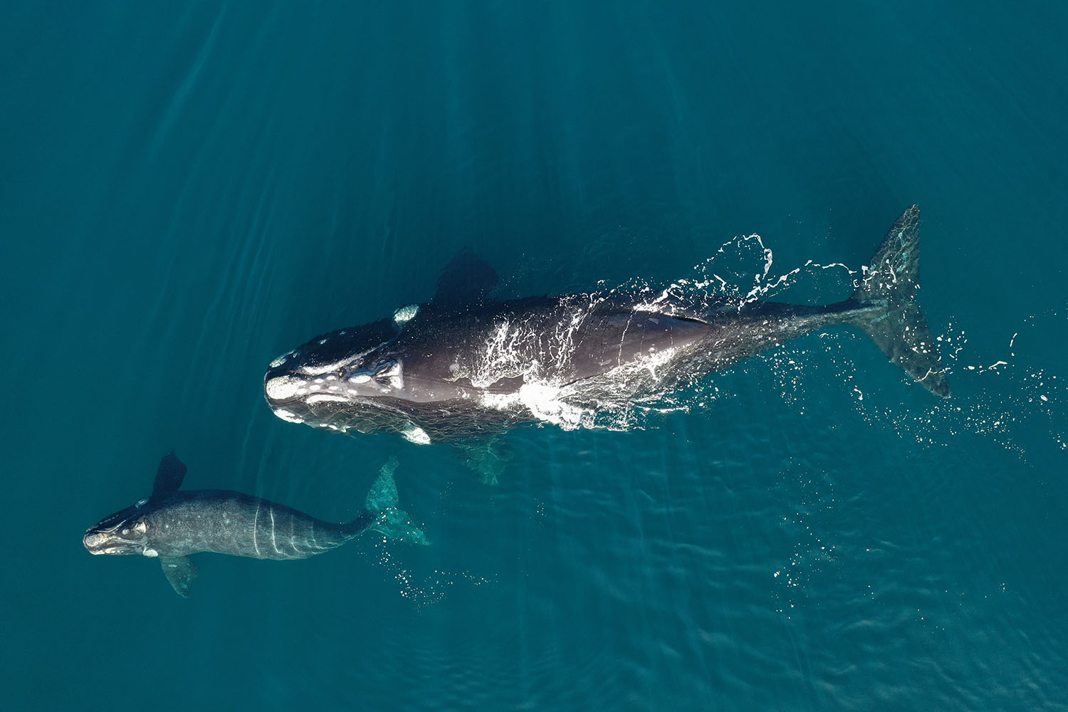
Monday November 7, 2022 – In a new cycle of the “Tracking Whales” project, 22 whales were tagged with satellite transmitters in September 2022 on the Argentine coast. Recording their travels within the north Patagonian gulfs and in the South Atlantic Ocean provides relevant information on key areas in the life cycle of this species. It also helps understand how they respond to climate change and promote targeted conservation actions.
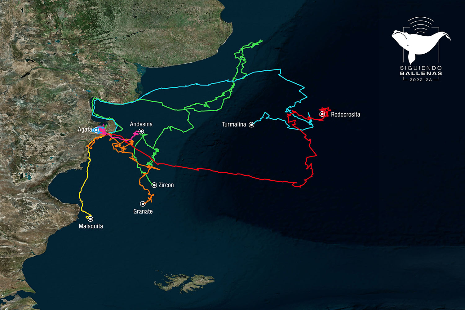
By visiting the website www.siguiendoballenas.org you will find daily updates on the whale’s travels which, this year, are identified by the names of gemstones, and grouped according to the area in which they were tagged: 16 in Golfo Nuevo (Chubut) and 6 in Golfo San Matías (Rio Negro).
At present, seven of the 22 whales have active transmitters: Agata, still in the quiet waters of Golfo Nuevo in Peninsula Valdés; Malaquita and Andesina which recently began their travels to feeding areas in the South Atlantic; Rodocrosita and Turmalina which have been in the deep ocean basin for approximately 3 weeks; and Granate and Zircon which are on the continental shelf.
The satellite tags stop transmitting signals when they become detached or when their batteries run out, which can occur weeks or months after deployment, depending on many factors.
Management and conservation
Since the beginning of this Project in 2014, and over 7 seasons, satellite transmitters have been deployed on 87 whales, allowing us to record their travels around Peninsula Valdés and the coastal front, and to learn about their migratory routes and feeding areas in the South Atlantic and sub-Antarctic areas.
Satellite tracking has disclosed information on aspects of the behavior of this population of whales which were previously unknown, especially in areas far from shore. Among other variables, the project´s scientists are studying how whales use the gulfs in northern Patagonia, and the speed and distance of their daily travels. In the last few years, they have also identified the areas and distances traversed during the complete migratory route of a female with calf, the differences in migratory routes by the same female whale in two different years –one as a mother and the other without a calf– and scored a record for the southernmost migration of a whale mother and calf.
This Project contributes scientific information to the objectives of the International Whaling Commission (IWC), of which Argentina is a party and member, particularly in relation to the Management Plan for the Conservation of the Southern Right Whale in the South Atlantic Ocean.
Technological innovation
Another contribution of this Project is the development of better technologies for the tracking of whales. The satellite transmitters used today have evolved since the beginning of “Tracking Whales”, in part because of the results of the Project´s research. Due to this fact, in the current season we are utilizing state-of-the-art devices to collect more and better-quality information during the tracking of each whale.
Some of the devices deployed this year will gather oceanographic data to understand how the whales utilize the marine environments and predict how they will react in the long term to climate change. This is the first time that such devices are being used in the Southern Hemisphere for whale research; their use, at one and the same time, is a worldwide innovation.
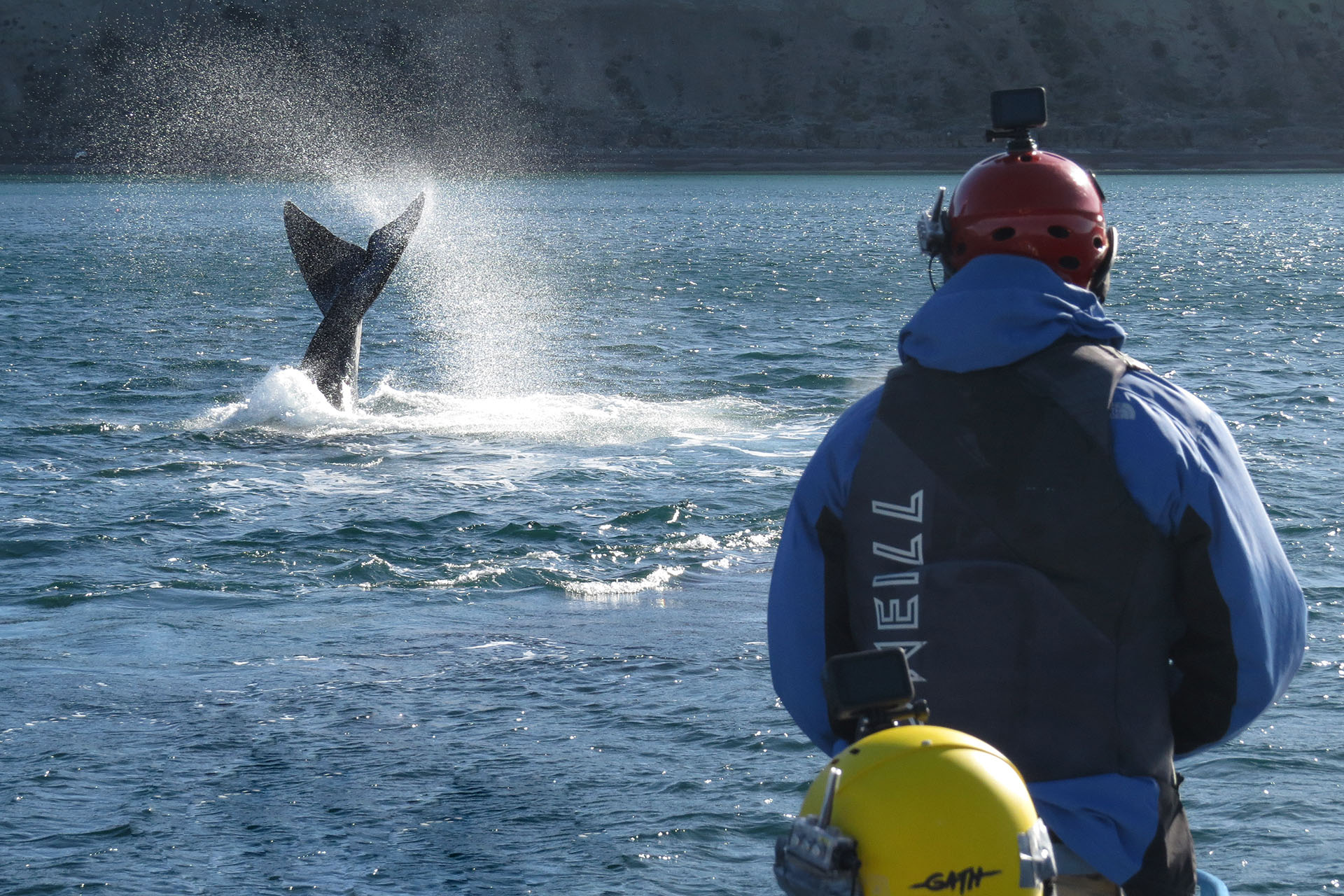
The Project scientists strive to use ever safer technology to guarantee the health and wellbeing of the animals, under the supervision of a highly competent team of veterinarians, biologists and bio-engineers. As time passes, the devices detach with minimum and brief or no effects on the behavior and health of the whales bearing them.
Global cooperation network
The sustained work over time, and the valuable results thus obtained, are possible due to the multi-institutional nature of this Project, which depends upon the cooperation and support of various institutions from Argentina, Brazil, Denmark and the United States.
“TrackingWhales” is possible via the collaborative effort of Laboratorio de Mamíferos Marinos del CESIMAR-CONICET, CIMAS-CONICET, Escuela de Ciencias Marinas (ESCiMar) de la Universidad Nacional del Comahue, Fundación Patagonia Natural, Instituto Aqualie, Instituto de Conservación de Ballenas, Marine Ecology and Telemetry Research and National Oceanic and Atmospheric Administration of the United States, the Southern Right Whale Health Monitoring Program, University of California Davis – Wildlife Health Center, and Wildlife Conservation Society Argentina. In the current season scientists from the Greenland Institute of Natural Resources, Marine Mammal Research of Aarhus University, and satellite transmitter manufacturers, Wildlife Computers.
The Project is funded by organizations from Argentina, Brazil and the United States, mostly for the technological development of the transmitters. Lessons learned from this study will be applicable to other whale populations in the world, particularly for those in endangered and in critical conservation status.
This Project is endorsed by the International Whaling Commission and the Argentina Ministry of Foreign Affairs. Permits are granted by the government of Chubut and Rio Negro provinces, with support from the Fauna and Flora Directory and Ministry of Tourism of Chubut and the Environment and Sustainable Development Secretariat of Rio Negro. The Project fieldwork and logistics are supported by the Coastguard of Puerto Pirámides and Puerto Madryn, the Whale Watching Captains Association and the Community of Puerto Pirámides, and the Asociación de Prestadores de Servicios Náuticos of the Municipality of San Antonio Oeste.
PRESS CONTACT:
Florencia Lemoine, Coordinadora de Comunicación WCS Argentina, +54 9 11 3317-1923, flemoine@wcs.org
Marcela Uhart, Directora Programa Latinoamericano, Wildlife Health Center, Universidad de California Davis, +54 9 280 469-6332, muhart@ucdavis.edu
Santiago Fernández, Investigador, Laboratorio de Mamíferos Marinos, CESIMAR CCT CONICET, +54 9 34 0143-4922, sfernandez882@gmail.com
María Victoria Coppini, Responsable de Comunicación y Prensa, Instituto de Conservación de Ballenas, +54 9 11 4026-6755, comunicacionyprensa@icb.org.ar
Florencia Rey, Fundación Patagonia Natural, +54 9 280 4305-5115, florenciarey95@gmail.com